I have been scouring through the internet looking for the best weather information to integrate with a dashboard, and a lot of the information posted no longer works. Either the APIs are no longer free or something with the data broke. Here is the best information that I could find in December 2023.
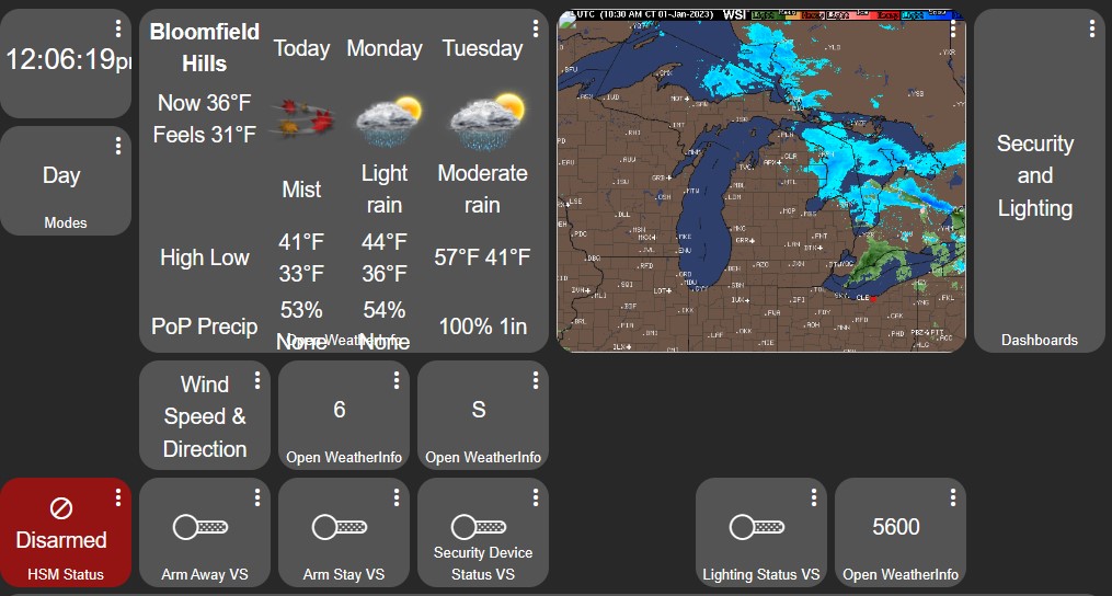
To integrate images in Hubitat Dashboard create a new tile, and do not assign the tile to a device. Instead under Template, select "Image" and then insert the URL in "Image URL".
Please note that while you are searching for weather to make sure that it is providing the latest data. I have found a few websites where the images were old.
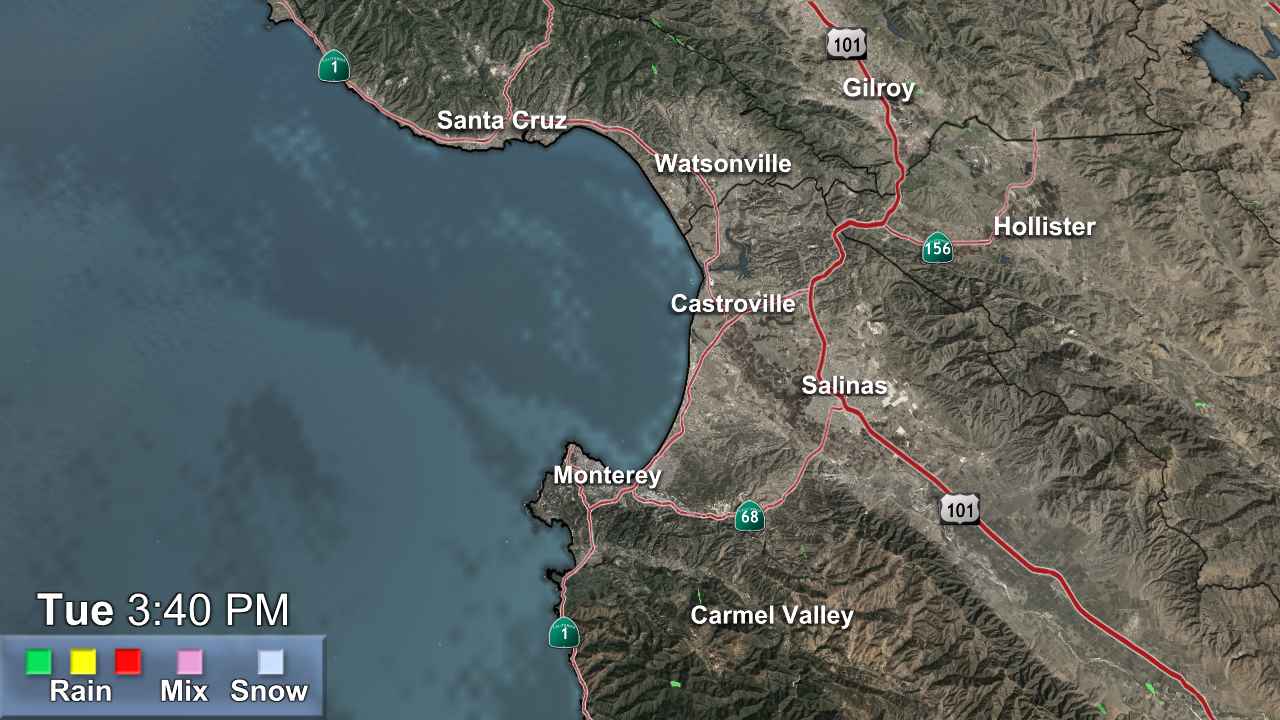
LOCAL NEWS STATION and WEATHER MAPS
You may or may not find good data with this method
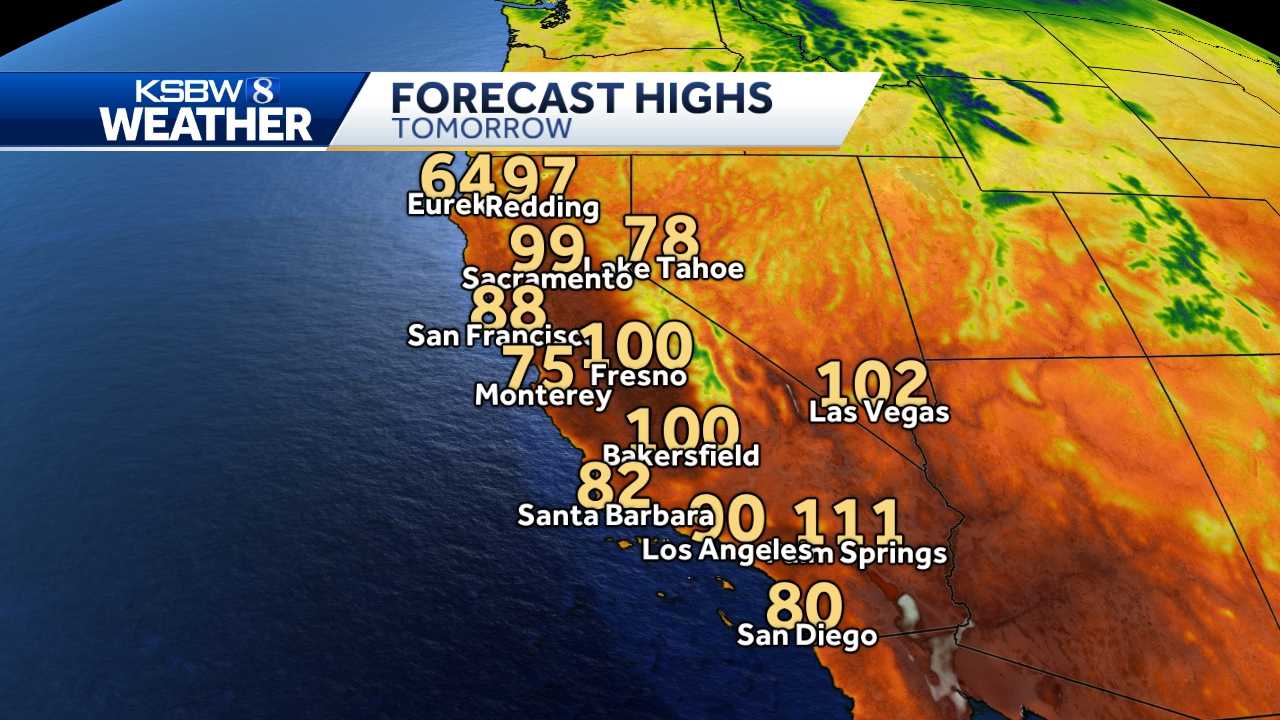

My local news station
https://www.ksbw.com/article/map-room/2530828
Go to the weather section of your local news station, and see if they display images for their weather. Sometimes you get lucky, other times it's a javascript or some other function that isn't easy to integrate into the dashboard. KSBW is a local station in my area and they have a cool FORECAST TOMORROW image.
You can also try to do a google search for WEATHER MAPS. It may come up with something useful for you.
LOCAL ABC WEATHER STATIONS
Most reliable non-animated radar
Go to your local ABC weather station, and go to their weather section to find good image content.
It maybe good to try browse to other ABC weather stations because they may have something that you may like. If you do not know your local ABC weather station, search for "ABC Weather" in google. Google will use your location and give you some close approximates.
WEATHER.GOV

https://radar.weather.gov/region/conus/standard
You can get animated weather information for your area by using weather.gov. It's not the closest Zoom in, but it should be sufficient for it being free. Go the link above, and click on PAN. Pan to your general location, then copy the image loop GIF link.
NOAA Images
https://www.star.nesdis.noaa.gov/GOES/sector.php?sat=G18§or=wus
I'm not going to include an image here, but NOAA provides a lot of different options. For the upper bar, click on the area that you want. This includes areas outside of the USA.
https://graphical.weather.gov/sectors/pacsouthwest.php
Additional map images. Just PAN to your area. There are a lot of choices.
WeatherDOTcom Maps
https://weather.com/maps/currentusweather
Many North America and Global Maps
Weather Underground Weather Maps
Yesterday Map
https://www.wunderground.com/maps/radar/yesterday/bfl
Go here and change your region to find a map in your area. Click on Animate before copying the image link for the animated version.
WEATHER FORECAST WIDGET
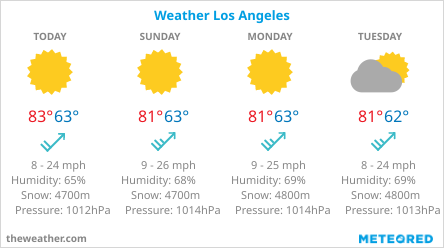
If you want the forecast, there are two methods that I have seen. The first, which I've seen a lot of people post is using the ABC Local weather 7-day forecast. It's fine and all, but it doesn't get your specific area. If you want to do it that way, just google "ABC weather" and scroll through your local weather stations website to find the URL.
https://www.theweather.com/widget/
I think the better method is to go to theweather.com and use their widget creator. You can customize it exactly how you want it. Before creating your widget, click on image. Grab the image hyperlink location.
AIR QUALITY
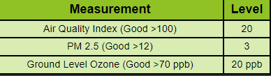
Air Quality is related to the weather and should be a factor since you only get two lungs. This isn't a map, but you can graph it out onto your dashboard.
Pull the data from the "Air Quality from AirNow" app on HPM and then create a chart using the "Tile Builder" App on HPM.
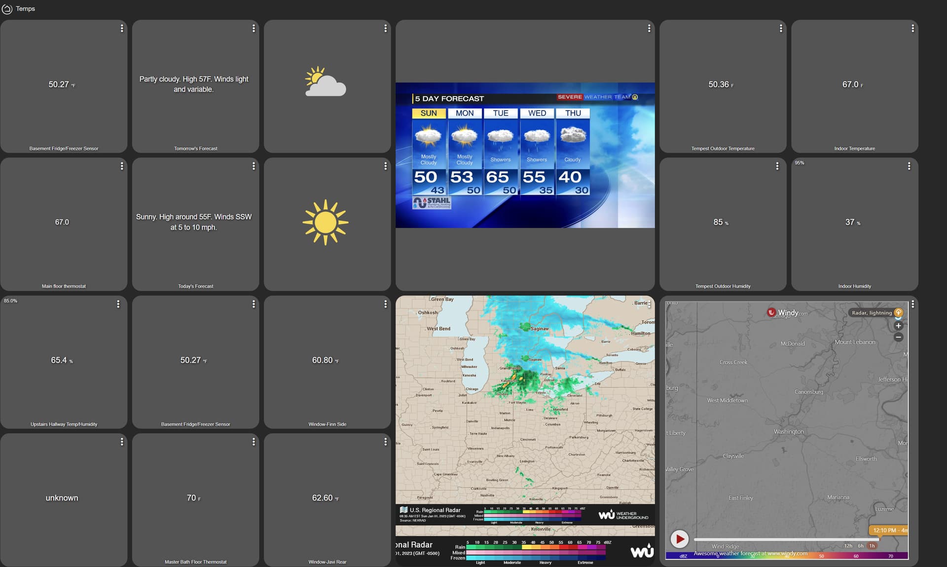
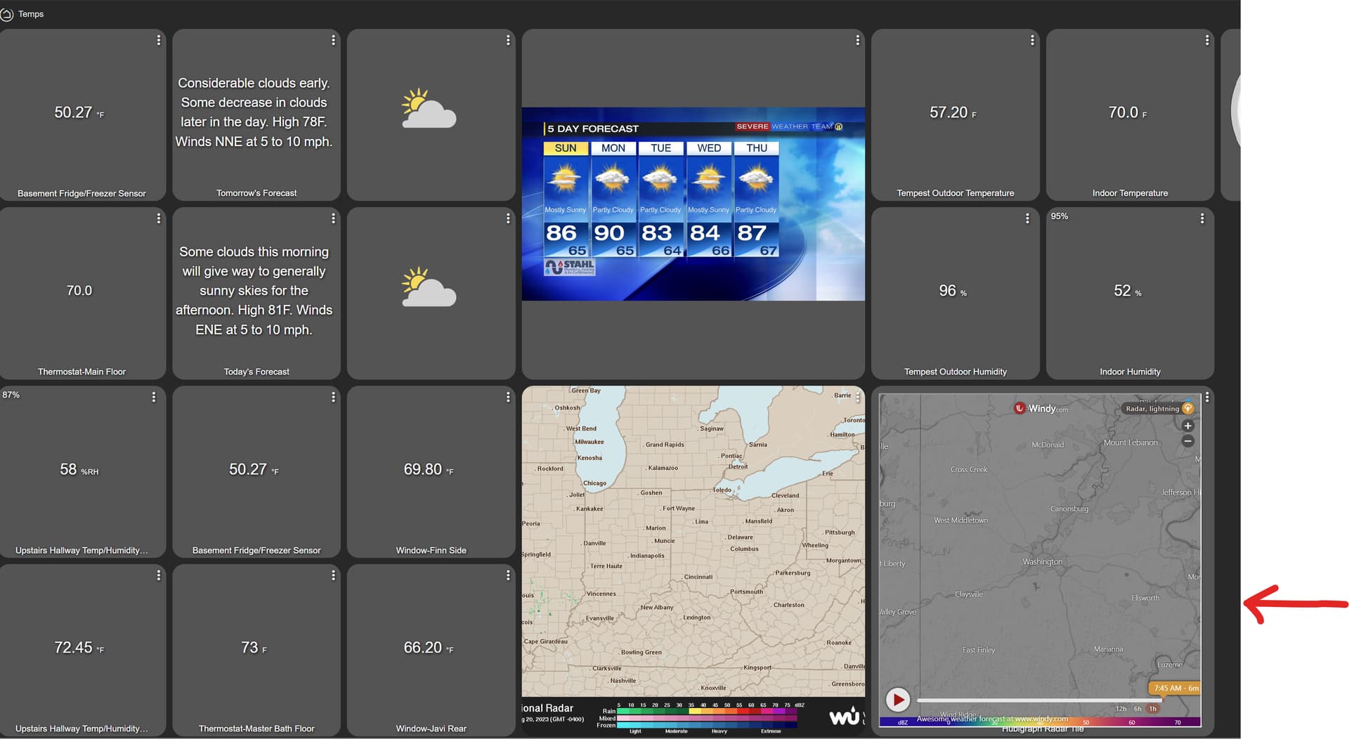
Precipitation Data
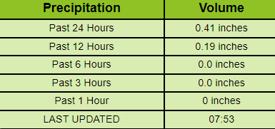
To create this chart, I use the data from the "Precipitation and Weather Monitor for National Weather Service Data" app on HPM and "Tile Builder" app on HPM.
Built-In OpenWeatherMap Driver
Weather API - OpenWeatherMap
If you get a free API from OpenWeatherMap, you can get your local weather in a driver. You can use it to do whatever you want.
Alternately, you can also download "OpenWeatherMap-Alerts Weather Driver" from HPM to get extra information. Follow the instructions from this link to get it working. Please note after you get the driver updated, it may take 15-30 minutes for the information to initially load; just be patient, and it will show up.
https://community.hubitat.com/t/openweathermap-alerts-weather-driver/38249/998
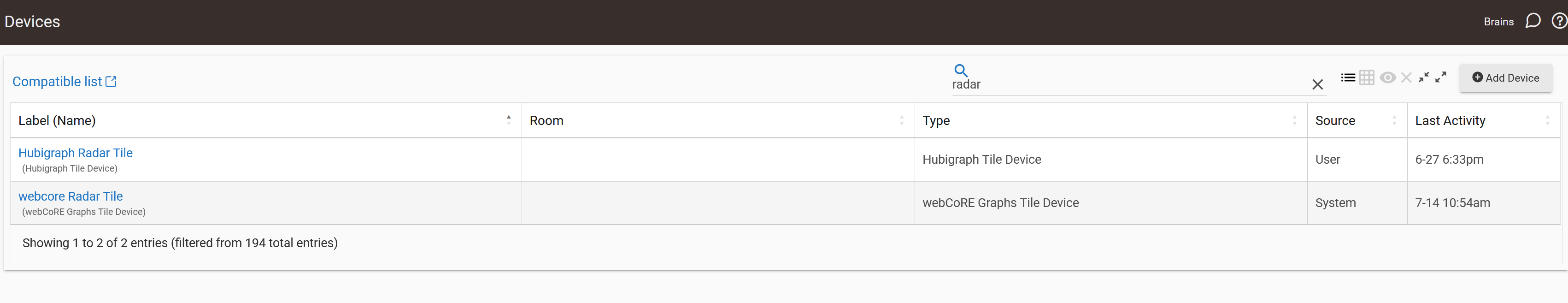
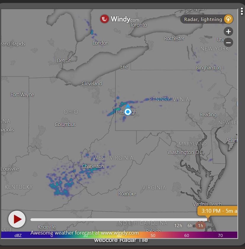
WEATHERdotCOM FROM HUBIGRAPH'S RADAR TILE
As rlithgow1 mentioned, Hubigraph's radar tile is a quick and easy way to get WindyDOTcom integrated into a tile. You can download Hubigraph from HPM.
EMBEDDING A WEBSITE INTO A TILE
There are some cool websites that maybe you want to embed into your website, such as windyDOTcom. To embed a website, use the "iFrameAdvanced" driver app on HPM. Please note that some websites have an HTTP header that do not allow iFrames to work. If your URL does not look, see if they have an EMBEDDED URL or WIDGET URL.


