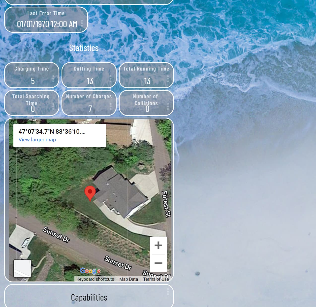
Does anyone know if someone has already created an App/Driver that can take the latitude and longitude attributes from some other HE device and then show a pin drop on a google map that can be displayed as a tile on a dashboard. For example the Tesla Connect app is able to return the lat/log of where is my car lets say Tesla HQ. If I could then take those attributes and pass to another app/driver that could produce a google map attribute to load a tile is what I woudl like to accomplish. What is on this page is the end result I would like to see as a Dashboard tile
To bring this back to the original conversation from the iFrame Advanced thread, it would be very easy to add a custom command to that driver to allow the setting of the url preference setting, which you could call from within an RM rule.
I know I suggested you setup a separate thread, which I still agree with, but it may be a simple thing for @mbarone to all to the iFrame driver...?
Getting more into the developer side of things...
Perhaps in addition to updates for the iFrame Advanced driver, it may also be an interesting project (for someone else ) to create a driver / app to cover the broader feature of device tracking. I'm thinking you could have an app that could cater for a number of devices being tracked, with parent HE devices for each, with component devices to cover tracking plus visualising these including using Google Maps, or potentially other display options.
That is easy for a static location but in this case my goal is to have a dynamic map that puts a pin drop based on the lat/log of attribute from another driver. I know I can create a rule to populate one driver based on attributes from another driver the question is how to query Google to get the iframe URL. I'm guessing there is probably a way to obtain all this using the Google Maps API but before I try and code all that I wanted to see if someone in the community has already done this.
Leveraging @mbarone iframe driver code I created a new version of the driver dedicated to displaying Google Maps based on latitude and longitude attributes. With this driver I was able to create a Hubitat Rule that triggers anytime the latitude or longitude attributes changes for my Tesla driver and then updates this new Google Maps Iframe driver with the current map location where my car is located. I'm also using this for other devices I have in HE that also contain Lat/Lon attributes to display map locations for those devices.
I've been attempting to create a Google Maps ifame advanced driver version based on @mbarone Iframe Advance code but as I'm new to Groovy Programming I stuck figuring out how to pass the values obtained from the commands into the "launcher" section of the code that are currently reading the values from the parameters section. If someone can point me to an example how to pass command values will be much appreciated.
Anyway, the code for the Google Maps iFrame driver is available at:
i've also made some changes if you want to take a look. and combine.. i added some functions so you can set the attributes with rules without needed extra variables. and then a fx to update the frame.. there were also some changes to the html as it wasnt honoring the zoom level and the language was in spanish instead of english
New version of the driver has been posted to GitHub that contains code contributions from @kahn-hubitat and @Baz2473 along with a new Parameter to set the Zoom level of Map.
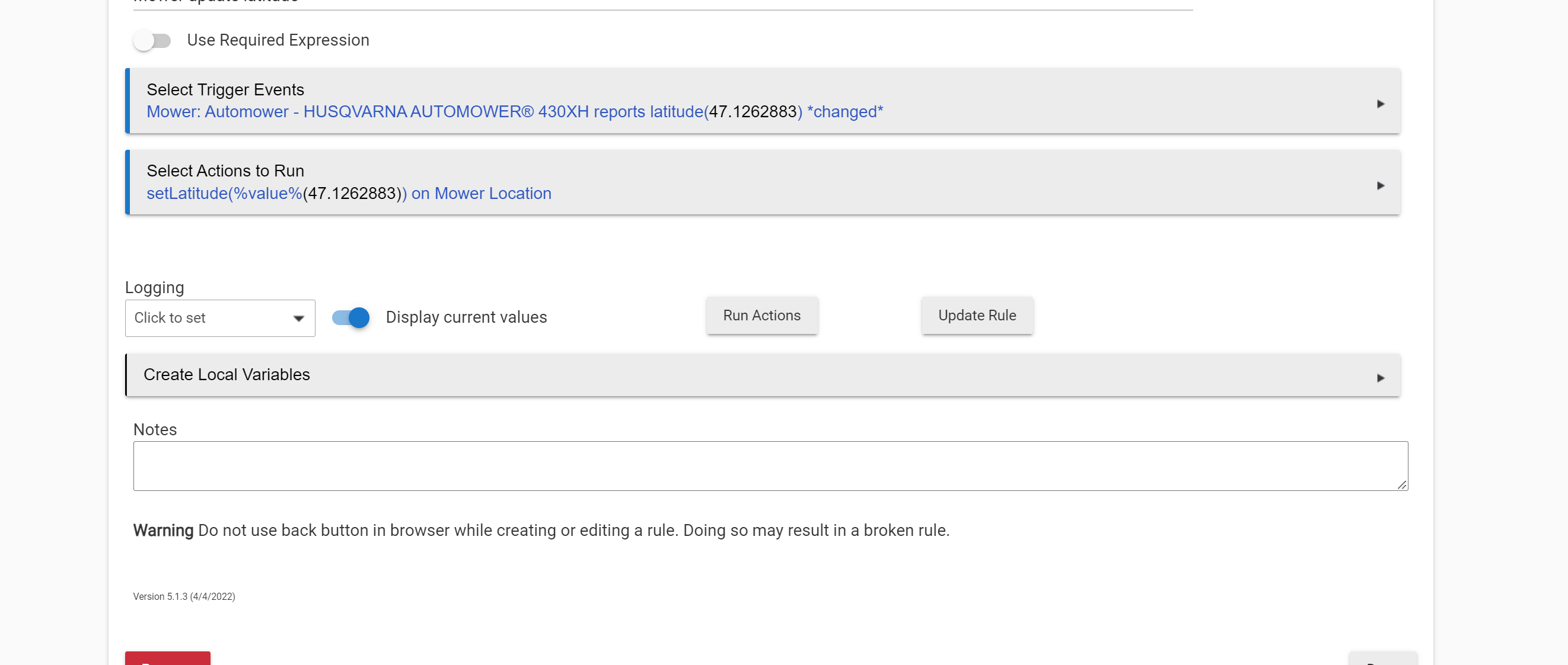
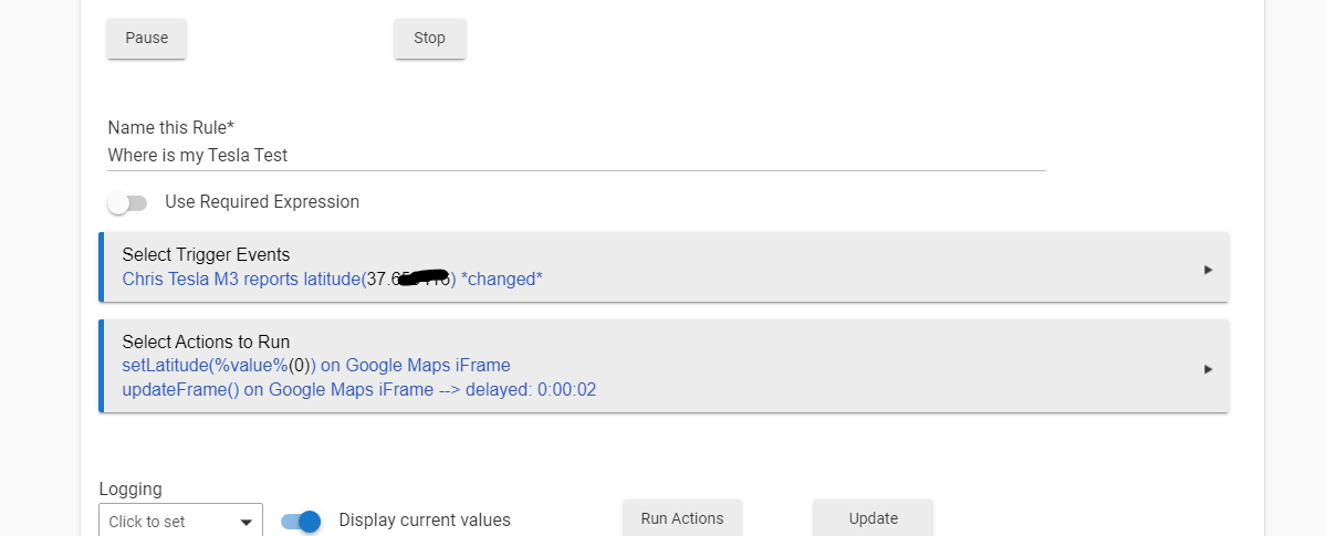
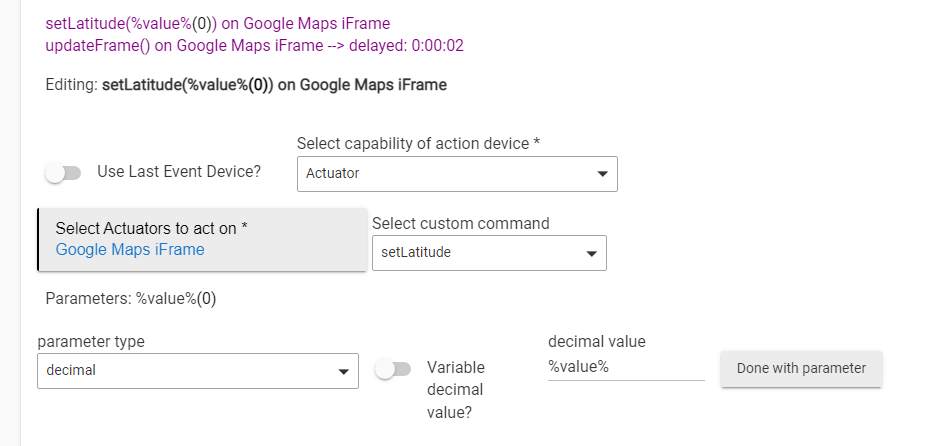
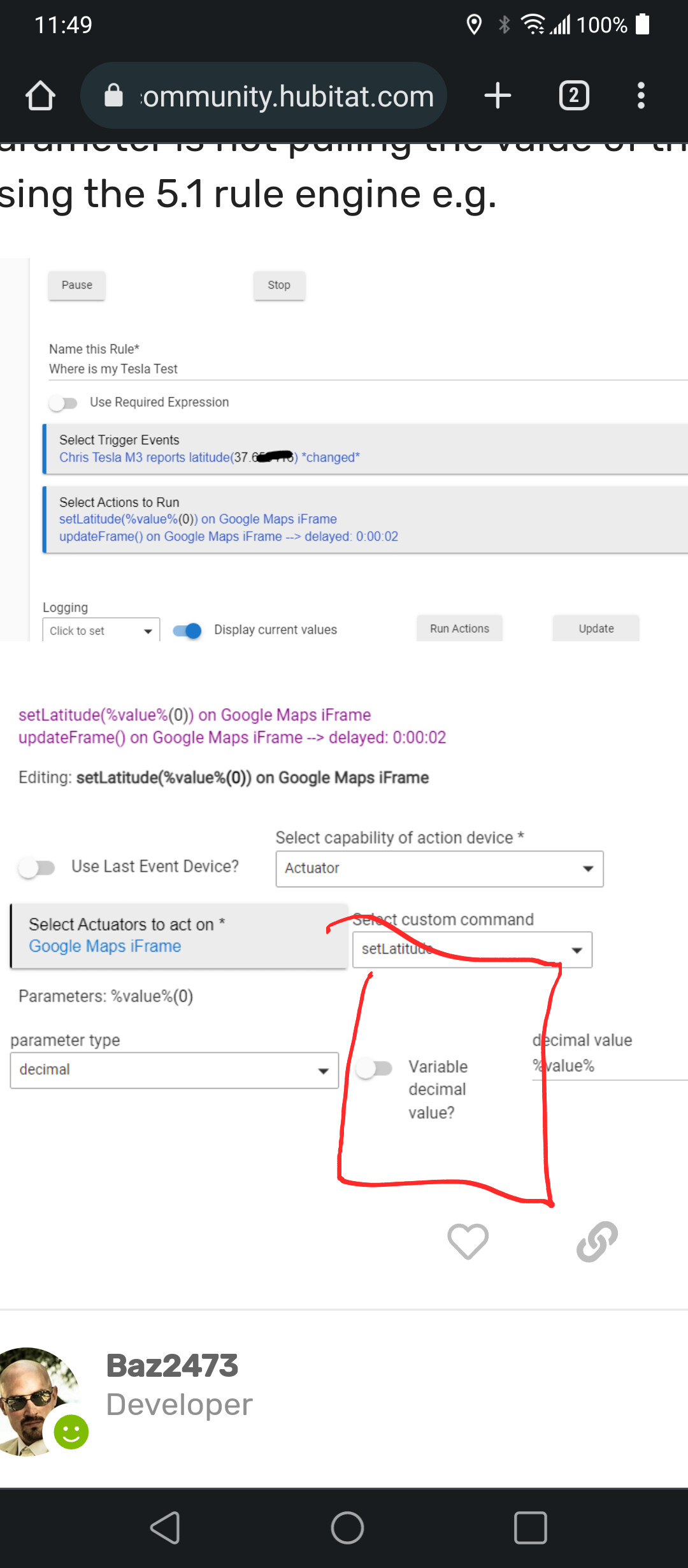
@kahn-hubitat Can you please provide a screen shot of your action parameter types? Using your version of the driver using the %value% for the parameter is not pulling the value of the attribute using the 5.1 rule engine e.g.
@kahn-hubitat you lost me on this one. Can you please provide screen shots how to get %value% to work or point me to where I can read how to do it. Thanks!
Thanks the trigger was the issue. As soon as I moved my car and the attribute changed the rule updated. Maybe someday the HE documentation will cover all this.
Hi @gomce62.web
Is it possible to present multiple locations on the same map?
The request is to use this driver with the Life 360 integration (that expose the latitude and longitude for each member into a dedicated device) and see all my family members on the same map.
Thanks,
This would require a lot of custom coding of the driver to pass all the required attributes to Google Maps to display multiple waypoints. The current version just accepts one waypoint.
 ) to create a driver / app to cover the broader feature of device tracking. I'm thinking you could have an app that could cater for a number of devices being tracked, with parent HE devices for each, with component devices to cover tracking plus visualising these including using Google Maps, or potentially other display options.